
Scott Peak
This peak, named after Winfield Scott an early settler in the area, is located just south of the Idaho/Montana border in the Beaverhead Range. It is not on the Continental Divide, but rather sits on a spur just south of the actual divide.
Like much of mountain Idaho, there is immense solitude lingering here. Few people climb this peak. It is remote and is hidden from view. However, it can be seen from a distance, sticking up above lower terrain, but little detail can be seen from so far away.
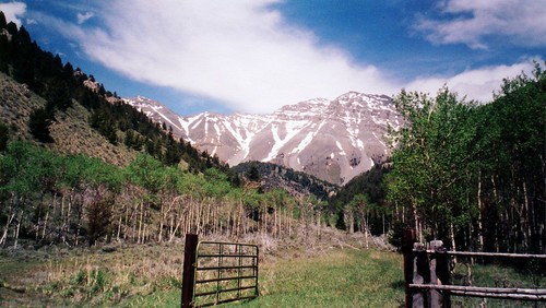
This shot from the trail head.....not really Scott, but the lower peak in front of it...
The shortest route from Scott Canyon is a class 3 scramble with the crux being a band of cliffs at around 10,500 feet. There are easier, but longer routes that can be utilized.
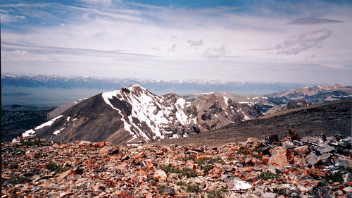
The top of this peak is broad and flat, you could drive a bus around on the summit, with magnificent views of the rest of the Beaverheads and the Lemhi Range. You can also peek into Montana here and there. Few people ever venture into this secluded corner of Idaho, and you will most likely find yourself alone on this high point of the range.
From the top, looking towards the Lemhi Range...
Getting There
From Idaho Falls, Idaho Drive north on I-15 to "Sage Junction" at exit #143, drive West through the hamlets of Terreton and Mud Lake. Just west of Mud Lake the you will encounter a junction, stay on 28 (to the right) and head towards Salmon, Idaho. From the junction drive 42.6 miles to the Nicholia Road, turn right onto this road and drive towards the Nicholia Mine for +- 3 miles, turn right and follow the road southeast for 4.5 miles and turn left up Scott Canyon to where the road is blocked at a gate. Lots of room to park here..
*** Note - It is recommend that a high clearance vehicle be used to get to the trailhead.
Red Tape
Like much of Idaho, no red tape or permits required. Practice no trace camping as a means to keep this area pristine. You will find this to be wild country, leave it like that also.
When To Climb
July to September are good months to climb this peak. It can be climbed out of season by those who have the experience.
Camping
Primitive camping can be found right at the trail head or along Birch Creek that flows for many miles along US 28. Be aware that Scott Canyon is dry most of the year so bring plenty of water.
Mountain Conditions
This Peak is located in Targhee National Forest. Information can be aquired at the Forest Service Office in Dubois Idaho at:
225 West Main
P.O. Box 46
Dubois, Idaho 83423
(208) 374-5422
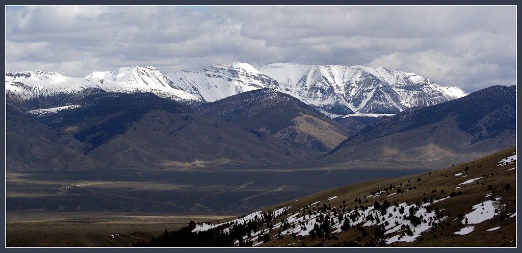
Like much of mountain Idaho, there is immense solitude lingering here. Few people climb this peak. It is remote and is hidden from view. However, it can be seen from a distance, sticking up above lower terrain, but little detail can be seen from so far away.
This shot from the trail head.....not really Scott, but the lower peak in front of it...
The shortest route from Scott Canyon is a class 3 scramble with the crux being a band of cliffs at around 10,500 feet. There are easier, but longer routes that can be utilized.
The top of this peak is broad and flat, you could drive a bus around on the summit, with magnificent views of the rest of the Beaverheads and the Lemhi Range. You can also peek into Montana here and there. Few people ever venture into this secluded corner of Idaho, and you will most likely find yourself alone on this high point of the range.
From the top, looking towards the Lemhi Range...
Getting There
From Idaho Falls, Idaho Drive north on I-15 to "Sage Junction" at exit #143, drive West through the hamlets of Terreton and Mud Lake. Just west of Mud Lake the you will encounter a junction, stay on 28 (to the right) and head towards Salmon, Idaho. From the junction drive 42.6 miles to the Nicholia Road, turn right onto this road and drive towards the Nicholia Mine for +- 3 miles, turn right and follow the road southeast for 4.5 miles and turn left up Scott Canyon to where the road is blocked at a gate. Lots of room to park here..
*** Note - It is recommend that a high clearance vehicle be used to get to the trailhead.
Red Tape
Like much of Idaho, no red tape or permits required. Practice no trace camping as a means to keep this area pristine. You will find this to be wild country, leave it like that also.
When To Climb
July to September are good months to climb this peak. It can be climbed out of season by those who have the experience.
Camping
Primitive camping can be found right at the trail head or along Birch Creek that flows for many miles along US 28. Be aware that Scott Canyon is dry most of the year so bring plenty of water.
Mountain Conditions
This Peak is located in Targhee National Forest. Information can be aquired at the Forest Service Office in Dubois Idaho at:
225 West Main
P.O. Box 46
Dubois, Idaho 83423
(208) 374-5422


Comments
Post a Comment